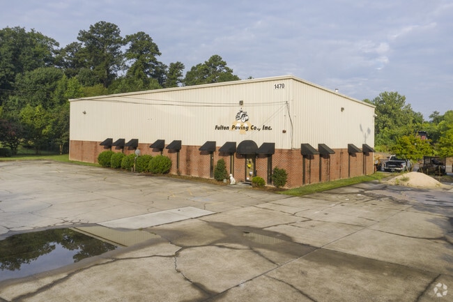
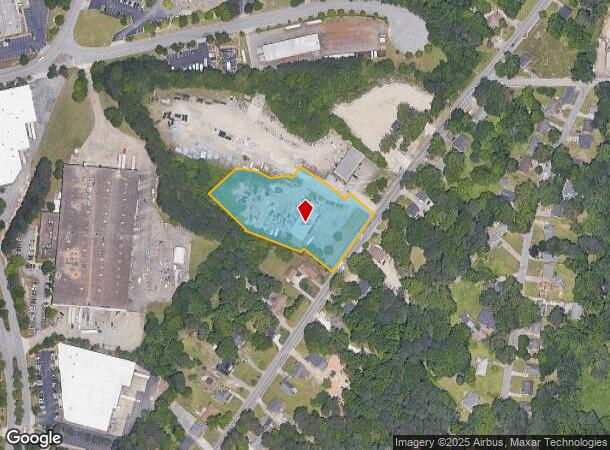
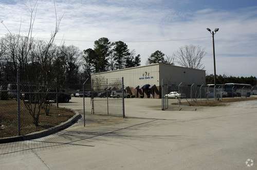
Property Record
1470 Bolton Rd Nw, Atlanta, GA 30331

This Property Is For Sale
NEARBY LISTINGS FOR SALE OR LEASE
Property Detail
1470 Bolton Rd Nw
Atlanta-Sandy Springs-Roswell, GA
Fulton
17-0261-0001-003-1
KA FULTON PAVING CO., INC FLD CK 10/24/18; NO 2ND BLDG ON PARCEL ID LEONARD JOHNSON - OWNER VERIFIED DATA 11/19, PHOTO,S
Warehouse
Fulton
X
Georgia
13121C0236F
261
2024
2.10 AC
2025
Fulton District
008602
Atlanta
7,600 SF
DEMOGRAPHICS near 1470 Bolton Rd Nw
1 Mile
3 Mile
5 Mile
2024 Total Population
3,711
61,607
196,726
2029 Population
3,858
64,322
204,354
Pop Growth 2024-2029
+ 3.96%
+ 4.41%
+ 3.88%
Average Age
37
37
37
2024 Total Households
1,526
24,871
83,117
HH Growth 2024-2029
+ 4.00%
+ 4.37%
+ 3.99%
Median Household Inc
$46,935
$66,311
$72,061
Avg Household Size
2.40
2.40
2.30
2024 Avg HH Vehicles
1.00
1.00
2.00
Median Home Value
$264,390
$326,266
$351,173
Median Year Built
1995
1990
1988
Nearby Places
Map Layers
Map Styles
 Street
 Aerial
- Restaurants
- Banks
- Shops
- Fitness
- Groceries
PUBLIC TRANSPORTATION
COMMUTER RAIL
DRIVE
WALK
Distance
17 min
9.8 mi
AIRPORT
Hartsfield - Jackson Atlanta International
DRIVE
WALK
Distance
Hartsfield - Jackson Atlanta International
27 min
17.2 mi
Nearby Properties
Address
Land Use
TOTAL SIZE
Lot Size
Zoning
Address
Land Use
TOTAL SIZE
Lot Size
Zoning
467,671 SF
4.82 AC
C1
Address
Land Use
TOTAL SIZE
Lot Size
Zoning
Address
Land Use
TOTAL SIZE
Lot Size
Zoning
3.25 AC
MU
Address
Land Use
TOTAL SIZE
Lot Size
Zoning
354,710 SF
25.27 AC
R5
Address
Land Use
TOTAL SIZE
Lot Size
Zoning
1,151,446 SF
I2
Address
Land Use
TOTAL SIZE
Lot Size
Zoning
439,167 SF
41.13 AC
RM-12
Address
Land Use
TOTAL SIZE
Lot Size
Zoning
538,535 SF
32.40 AC
I2
Address
Land Use
TOTAL SIZE
Lot Size
Zoning
499,198 SF
9.49 AC
RG3
Address
Land Use
TOTAL SIZE
Lot Size
Zoning
415,834 SF
17.62 AC
I2
Address
Land Use
TOTAL SIZE
Lot Size
Zoning
1,057,380 SF
17.43 AC
C1
Address
Land Use
TOTAL SIZE
Lot Size
Zoning
263,676 SF
15.70 AC
RM-12
Address
Land Use
TOTAL SIZE
Lot Size
Zoning
285.03 AC
I2
Address
Land Use
TOTAL SIZE
Lot Size
Zoning
694,436 SF
36.80 AC
HI
Address
Land Use
TOTAL SIZE
Lot Size
Zoning
251,706 SF
20.22 AC
RM-12
Address
Land Use
TOTAL SIZE
Lot Size
Zoning
237,515 SF
16.68 AC
C2
Address
Land Use
TOTAL SIZE
Lot Size
Zoning
1,012,150 SF
7.31 AC
C1
Address
Land Use
TOTAL SIZE
Lot Size
Zoning
553,853 SF
3.70 AC
RG4
Address
Land Use
TOTAL SIZE
Lot Size
Zoning
211,506 SF
20.63 AC
CRC
Address
Land Use
TOTAL SIZE
Lot Size
Zoning
520,556 SF
5.47 AC
RG2
Address
Land Use
TOTAL SIZE
Lot Size
Zoning
77.56 AC
RG3
Address
Land Use
TOTAL SIZE
Lot Size
Zoning
191,400 SF
25.70 AC
LI
Address
Land Use
TOTAL SIZE
Lot Size
Zoning
175,630 SF
5.06 AC
RM-12
Address
Land Use
TOTAL SIZE
Lot Size
Zoning
420,810 SF
23.48 AC
I1
Address
Land Use
TOTAL SIZE
Lot Size
Zoning
286,400 SF
17.29 AC
I2
Address
Land Use
TOTAL SIZE
Lot Size
Zoning
332,329 SF
4.99 AC
R5
Address
Land Use
TOTAL SIZE
Lot Size
Zoning
3,000 SF
11.42 AC
HI
Address
Land Use
TOTAL SIZE
Lot Size
Zoning
0.34 AC
I1
Address
Land Use
TOTAL SIZE
Lot Size
Zoning
229,860 SF
4.27 AC
RG2
Address
Land Use
TOTAL SIZE
Lot Size
Zoning
903,588 SF
6.94 AC
RG3
Address
Land Use
TOTAL SIZE
Lot Size
Zoning
55,788 SF
44.07 AC
I1
The World's #1 Commercial Real Estate Marketplace
Connect with us
© 2025 CoStar Group
The information above has been obtained from sources believed reliable. While we do not doubt its accuracy we have not verified it and make no guarantee, warranty or representation about it. It is your responsibility to independently confirm its accuracy and completeness. Any projections, opinions, assumptions, or estimates used are for example only and do not represent the current or future performance of the property. The value of this transaction to you depends on tax and other factors which should be evaluated by your tax, financial, and legal advisors. You and your advisors should conduct a careful, independent investigation of the property to determine to your satisfaction the suitability of the property for your needs.